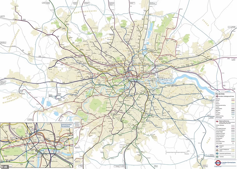
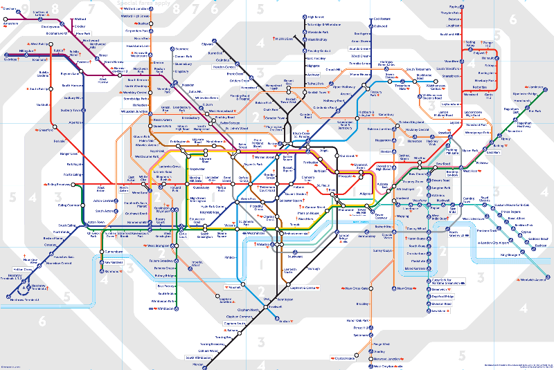
I love drawing maps. Mainly because there is a dimension to it that is very much about user experience versus perceived truth. A classic example of this is the London underground map drawn by Harry Beck in 1933. The truthful representation of the London underground is to be honest quite useless. The stylised and simplified version however, is an iconic map over London. It has shaped our perception of the city, although not always for the better.
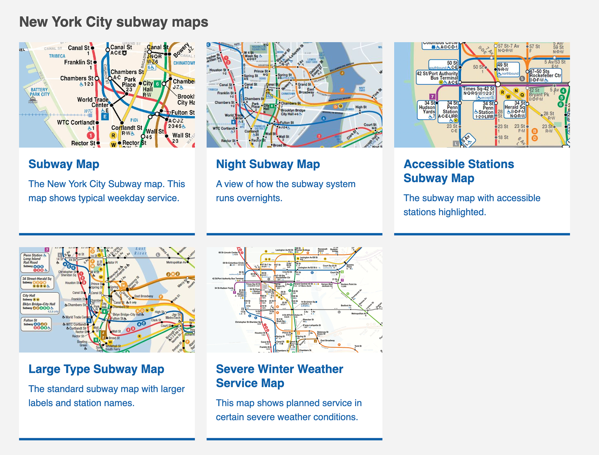
The new york underground has take it one step further. They have not only stylised the map but also expanded upon it with several different versions of the map.
These examples all make it very clear that maps don't always need to be 100% accurate. In fact, its only since the later part of the 1900s that we really see maps that are accurately scaled versions of real geography. We have seen an increase in usage of services such as Google maps in conjunction with displaying public transport lately resulting in decreased usage of stylised maps.
People seem to miss the overall sense of a town that the tube styled maps can give. When I used to work at Västtrafik in Gothenburg with this, website users often looked for whole maps, overview of a route or line. It seems to be deeply ingrained in us to use maps when planning travels.
My conclusion is that maps do not have to be geographically accurate, they need to work for specific needs. To answer question such as "Where is this area in comparison to the city centre?" or "Are these stops located near each other?" And we have a trend where we tend to use the GPS style maps we have in our phones more, even in transportation apps, leaving how a city is perceived up to software companies.
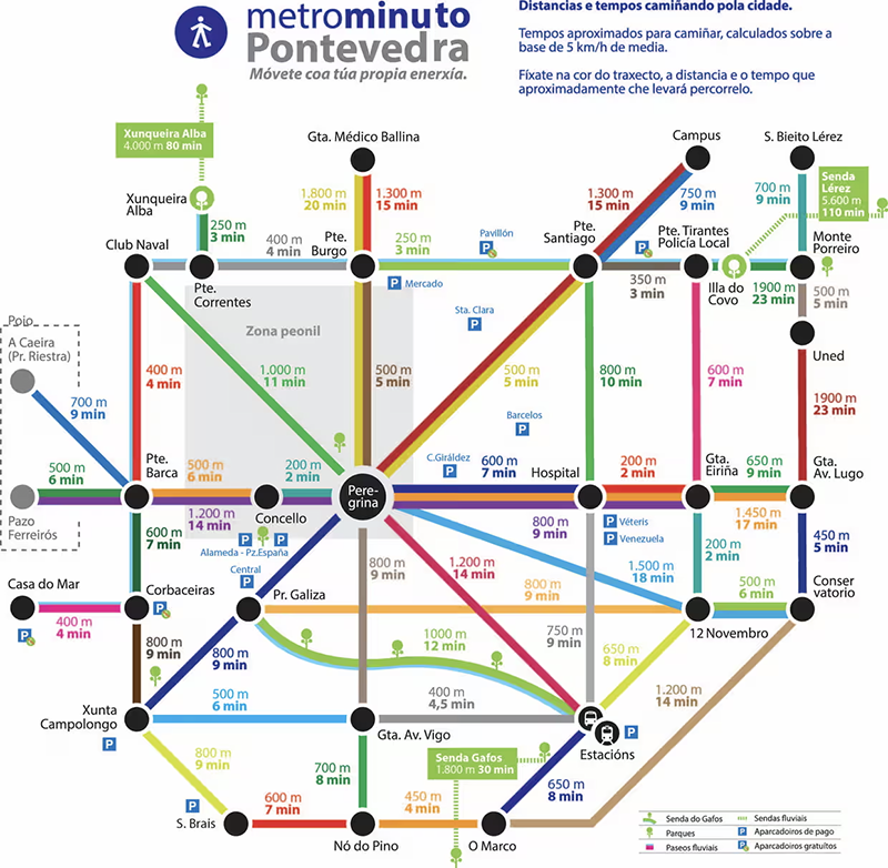
To end this on a high note, here is the tube styled map for the Spanish city of Pontevedra, where cars are banned, complete with "stops" and walking distance.
My conclusion is that maps do not have to be geographically accurate, they need to work for specific needs. To answer question such as "Where is this area in comparison to the city centre?" or "Are these stops located near each other?" And we have a trend where we tend to use the GPS style maps we have in our phones more, even in transportation apps, leaving how a city is perceived up to software companies.
To end this on a high note, here is the tube styled map for the Spanish city of Pontevedra, where cars are banned, complete with "stops" and walking distance.